

Maps (2145 Subjects)
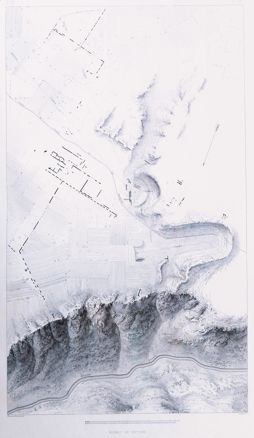
Topographical map of ancient Sicyon, with the sites of the ancient theatre and the stadium.
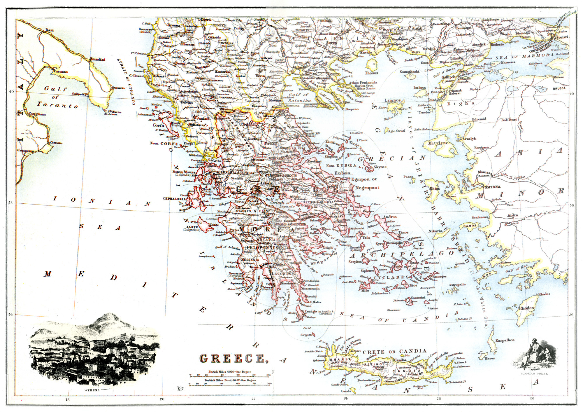
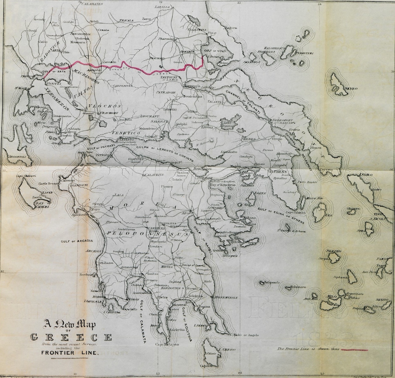
Map of Greece.
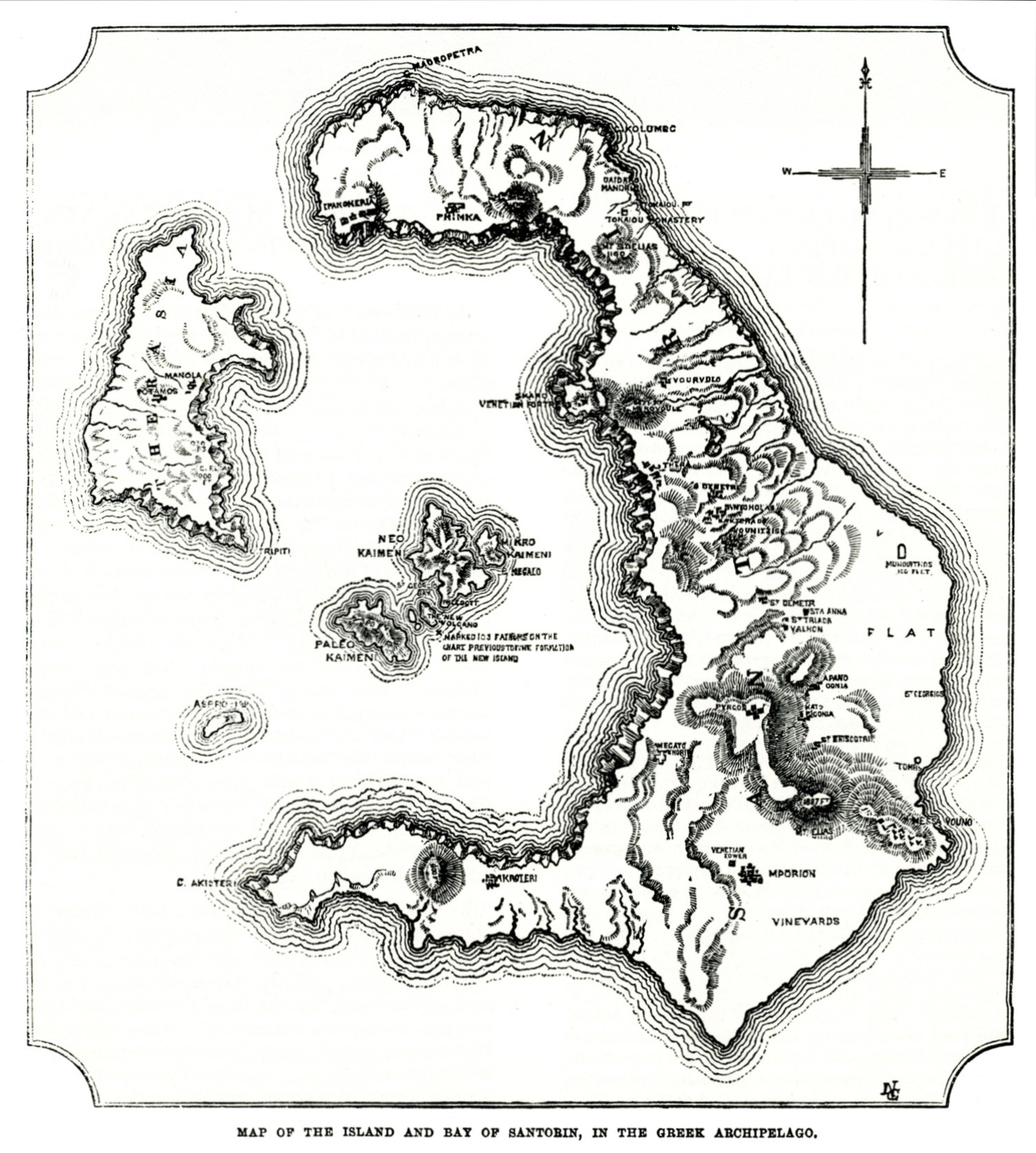
Map of Santorini island, 1866.
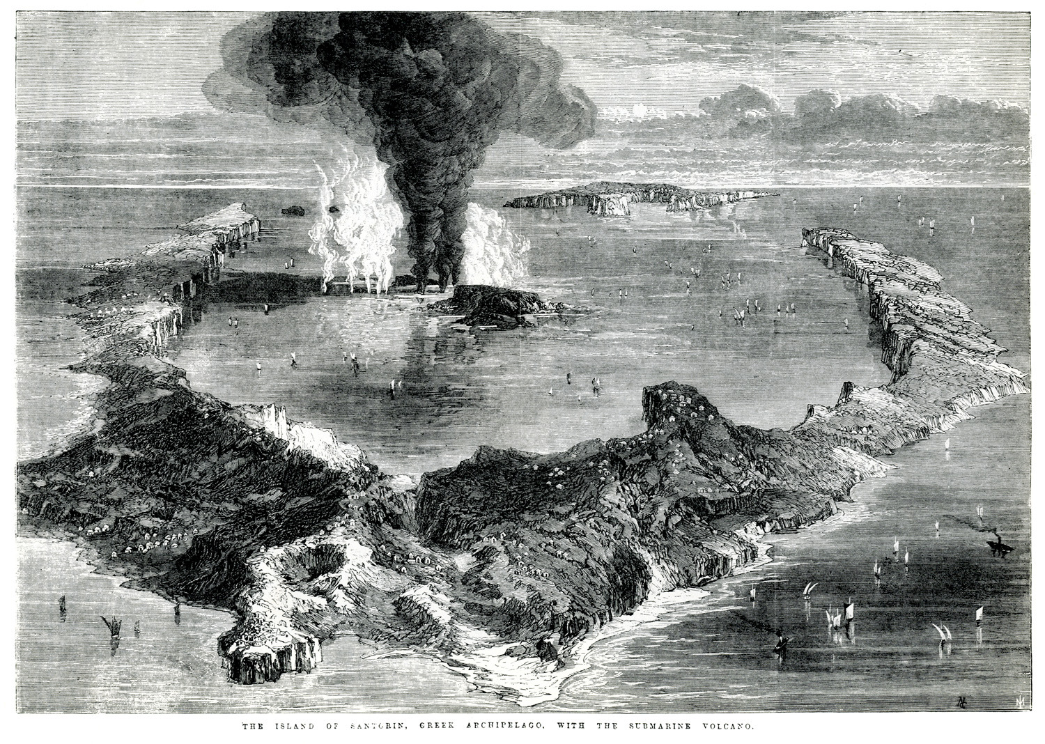
Santorini and the islet of Nea Kameni, 1866.
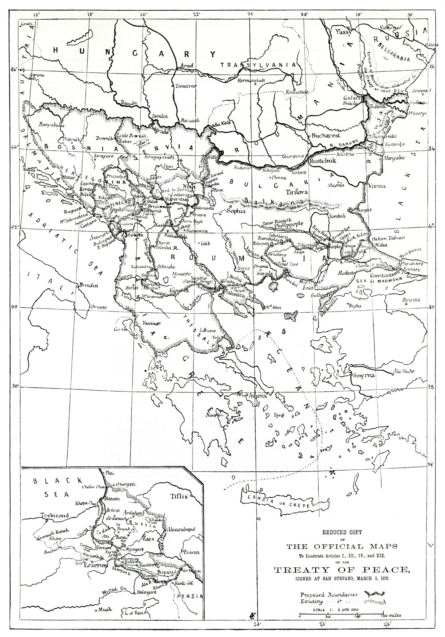
Map of the Balkan peninsula after the treaty of San Stefano, 1878.
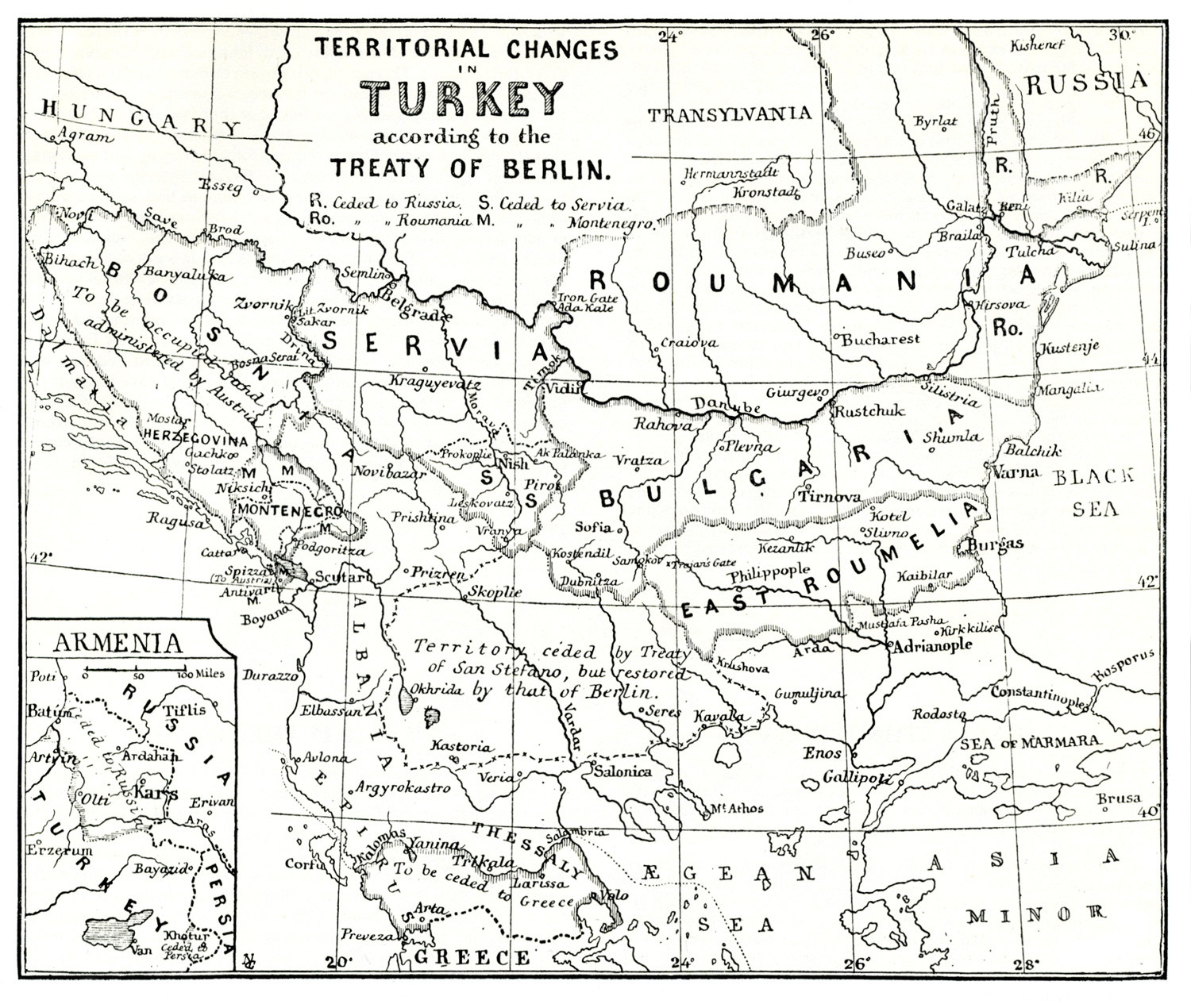
Map of Southeastern Europe after the Berlin Treaty (1878).
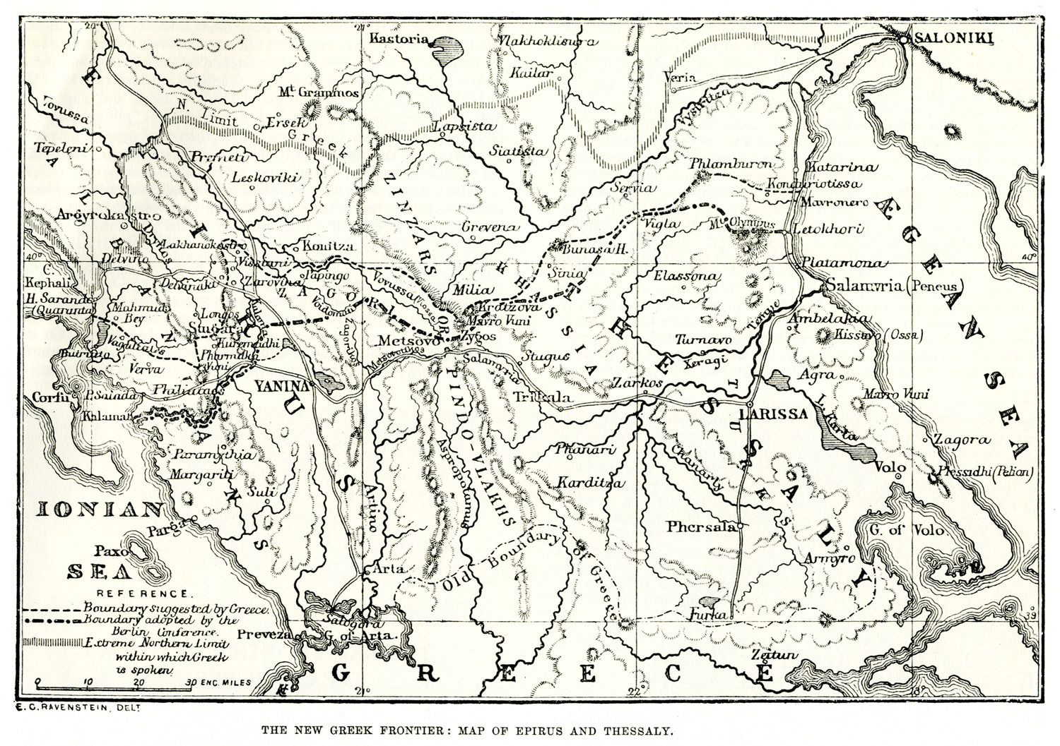
Map of the new territories acquired by Greece after the Treaty of Berlin in 1878. Ioannina did not in fact become Greek territory until the 1913 Treaty of Bucarest, after the Balcan Wars. The proposition that it be ceded to Greece in 1878 was rejected by the Congress of Berlin due to the reaction of the Ottoman side. With the Treaty of Berlin the Kingdom of Greece acquired Arta and adjacent area.
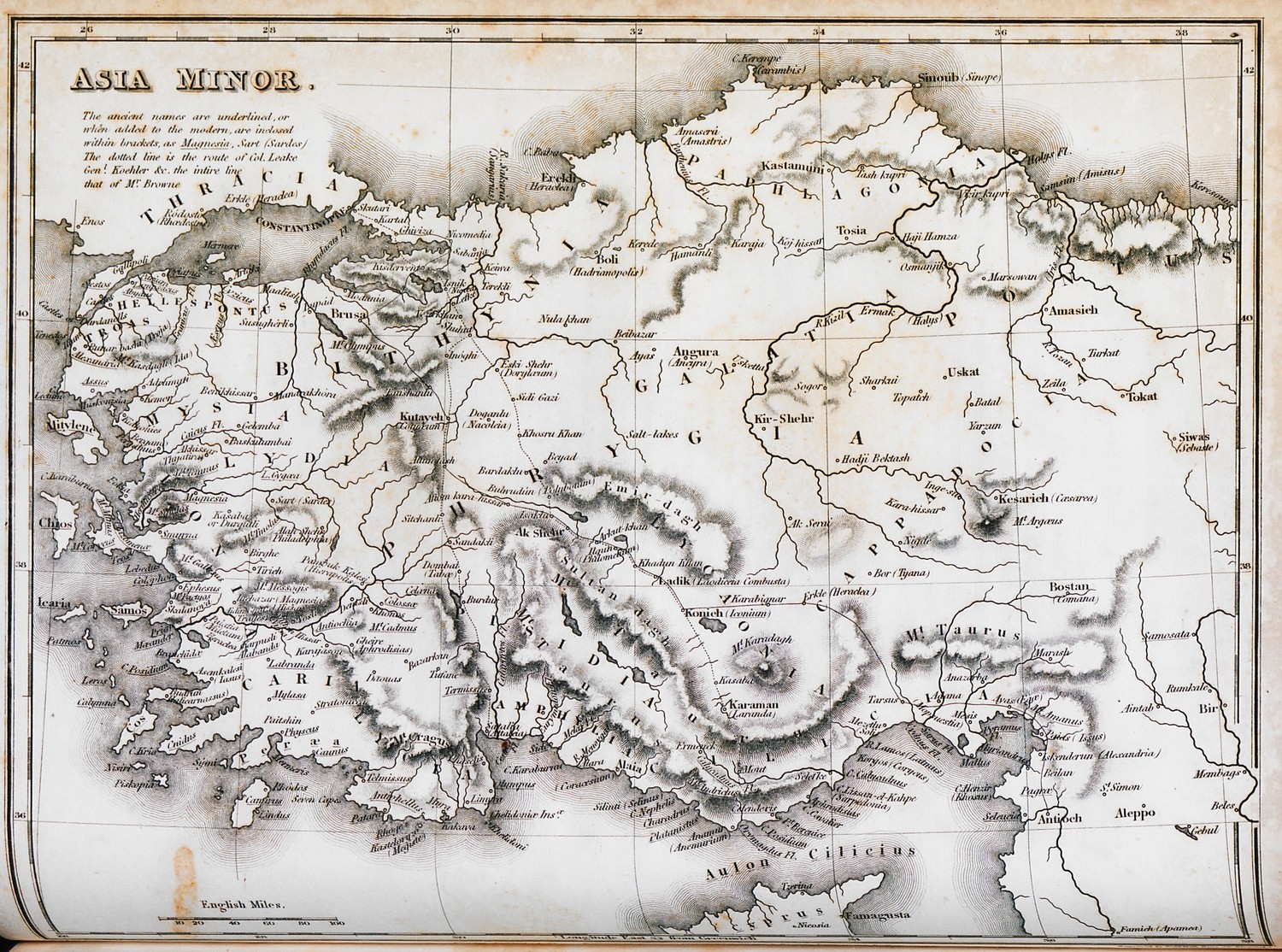
Map of Asia Minor.
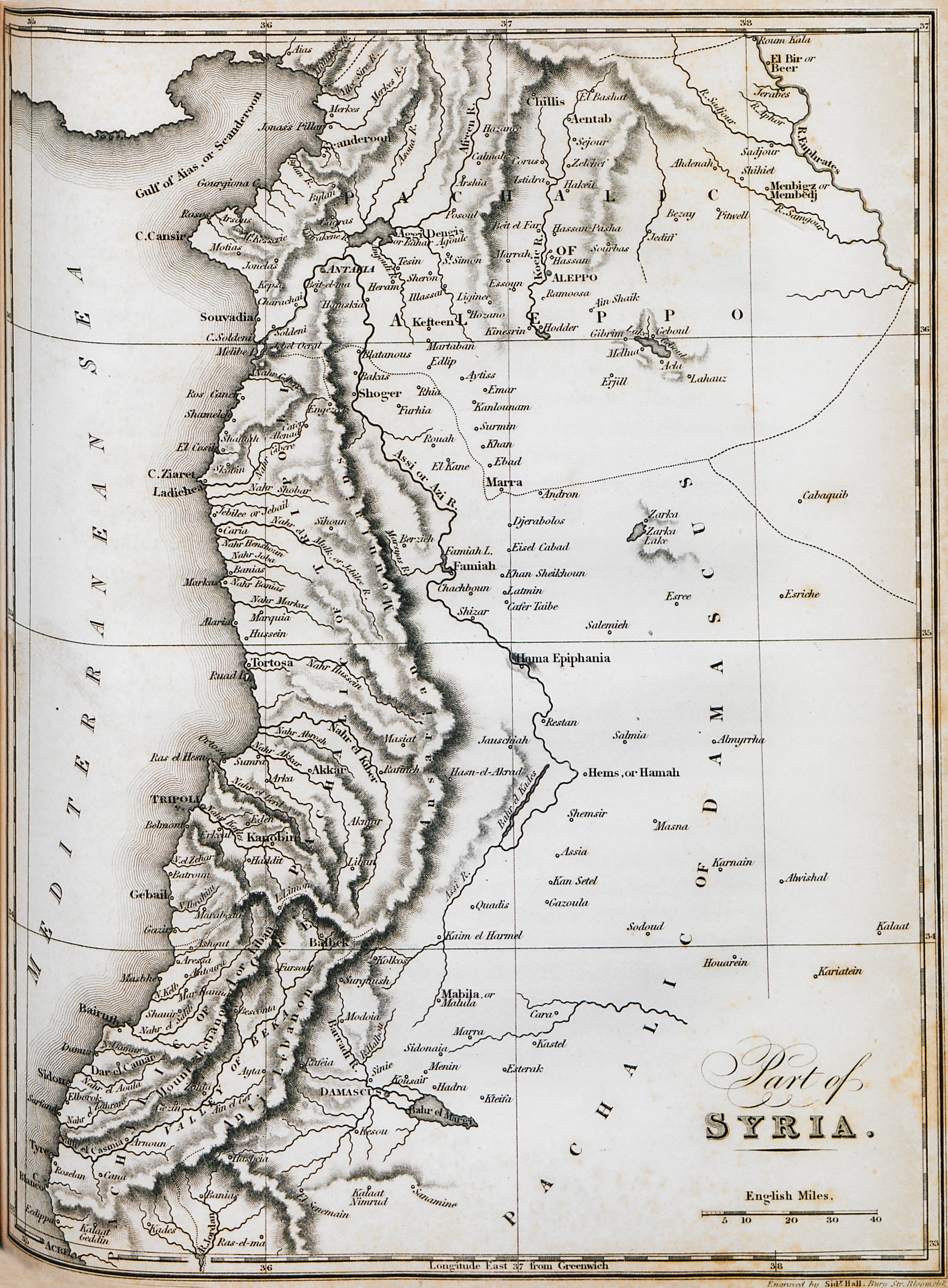
Map of the coasts of Syria and Lebanon.
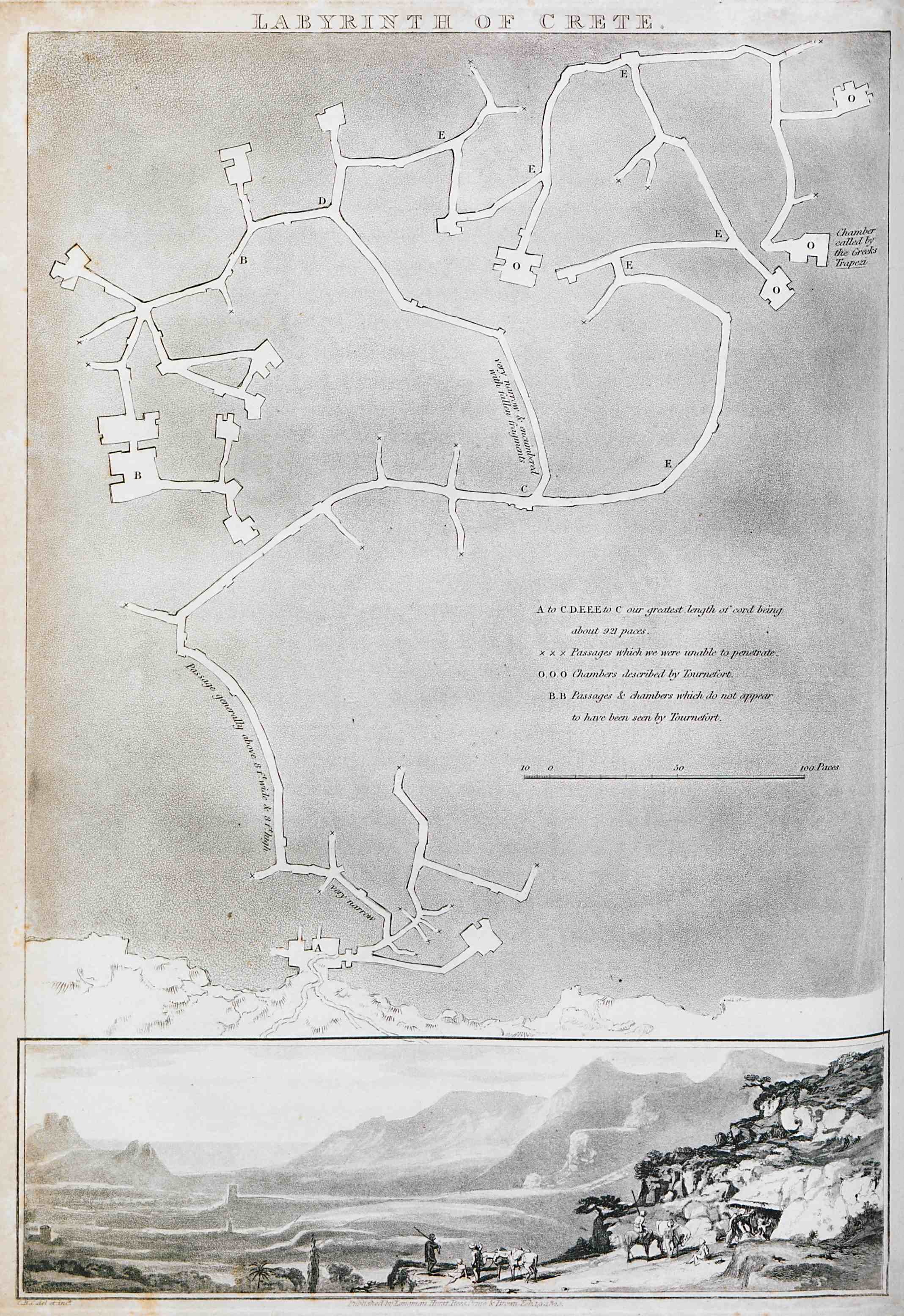
Map of the site of ancient Gortyn, Crete. View of Gortyn.
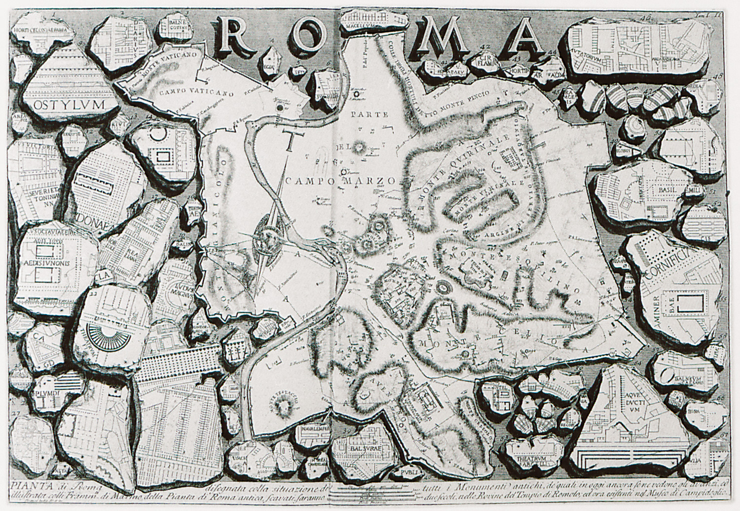
Map of Rome. To the right and left, marble fragments with views and plans of the city's monuments.
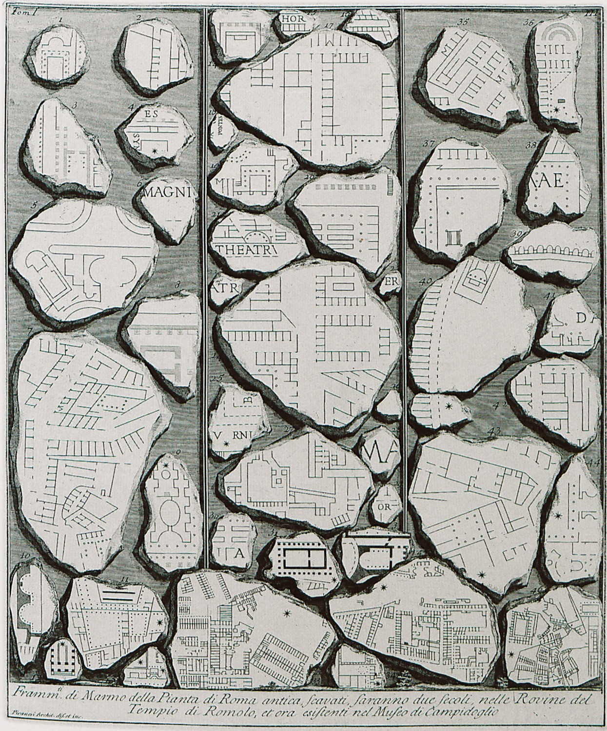
Fragments of the marble plan of ancient Rome called Forma Urbis Romae, or Severan Marle plan, created under Septimius Severus.
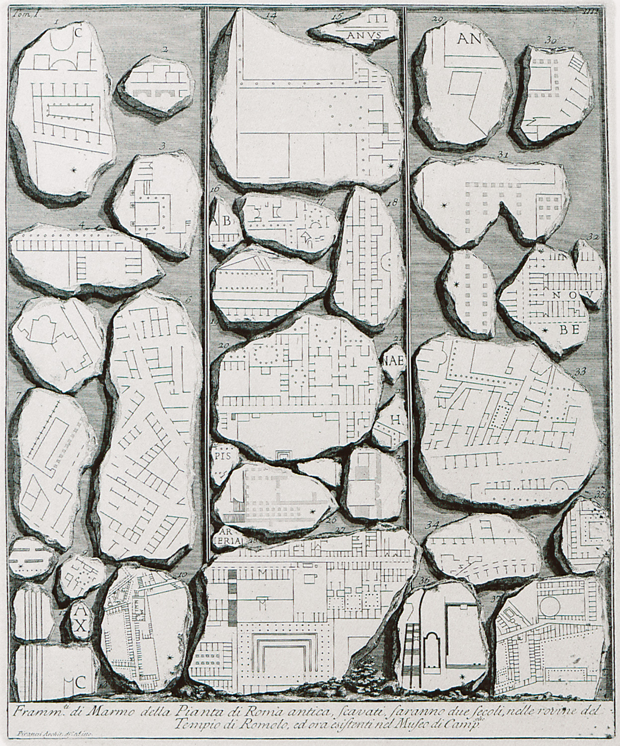
Fragments of the marble plan of ancient Rome called Forma Urbis Romae, or Severan Marle plan, created under Septimius Severus.
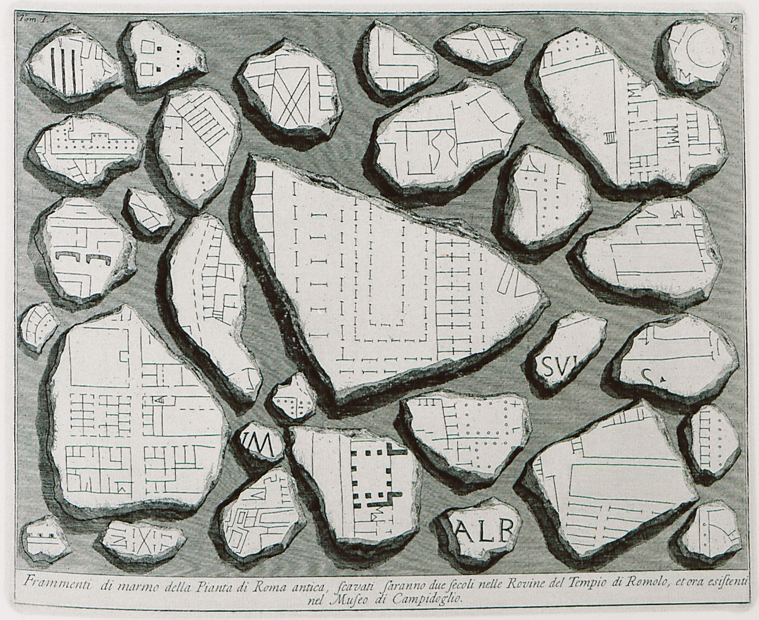
Fragments of the marble plan of ancient Rome called Forma Urbis Romae, or Severan Marle plan, created under Septimius Severus.
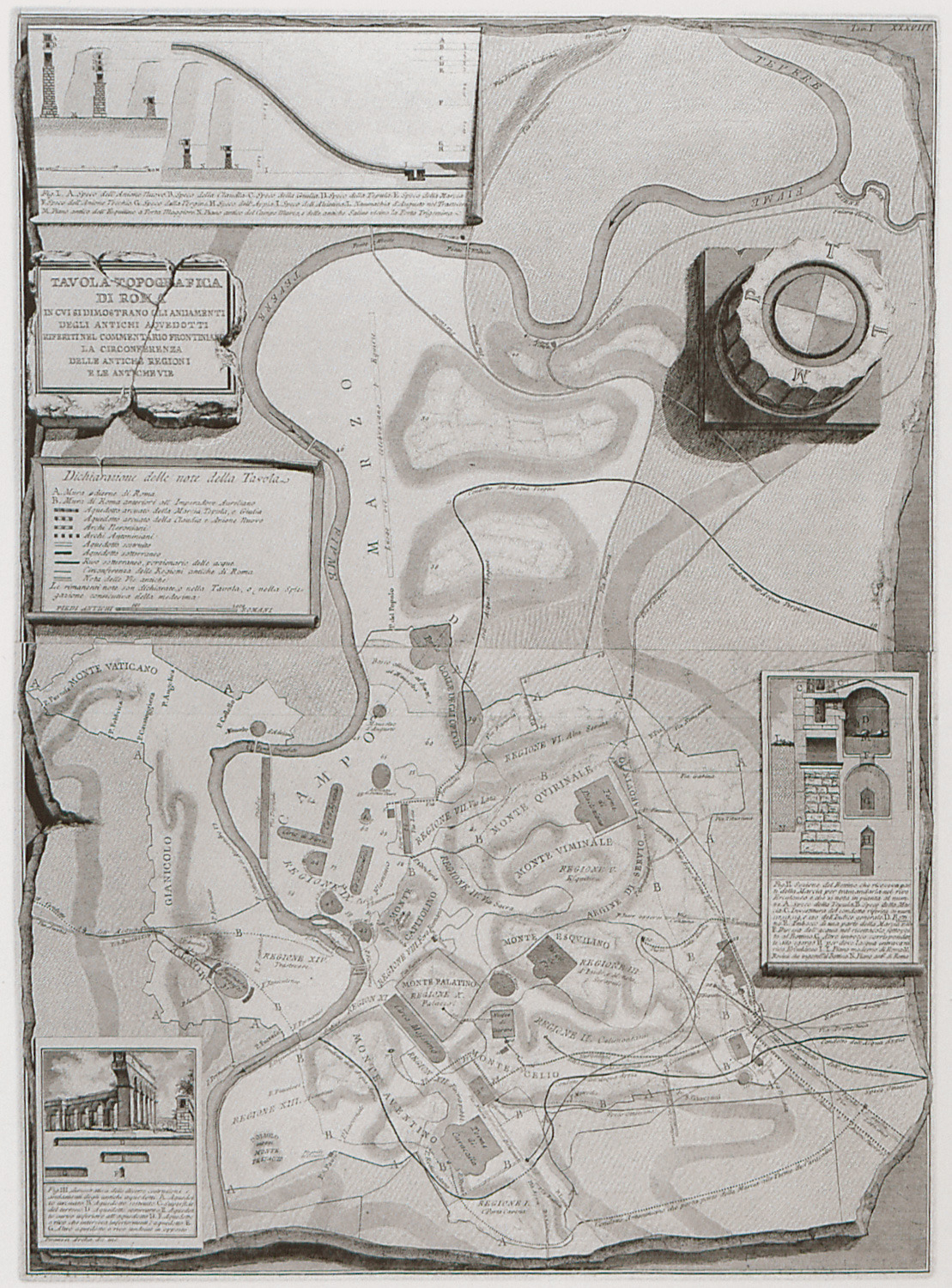
Topographic map of ancient Rome.
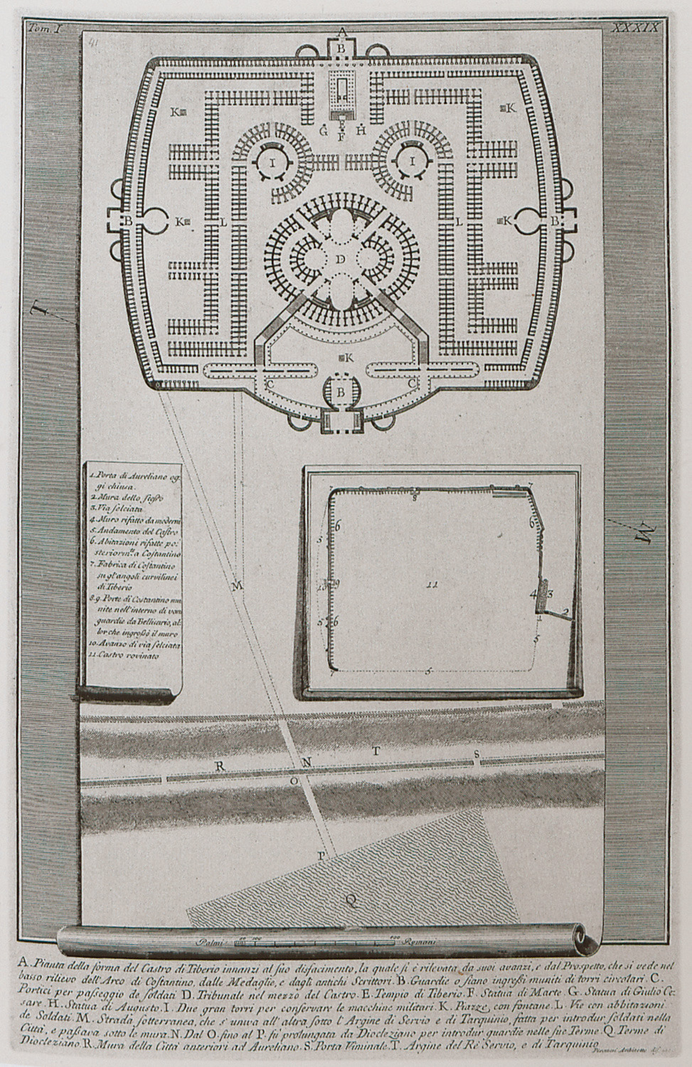
Plan of the barracks of the Praetorian guard, Rome.
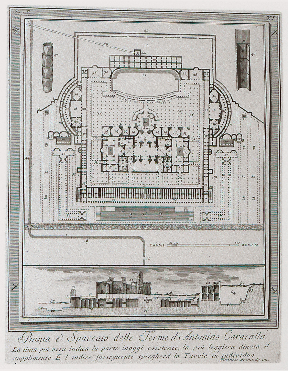
Plan and section of the Thermae of Caracalla, Rome.
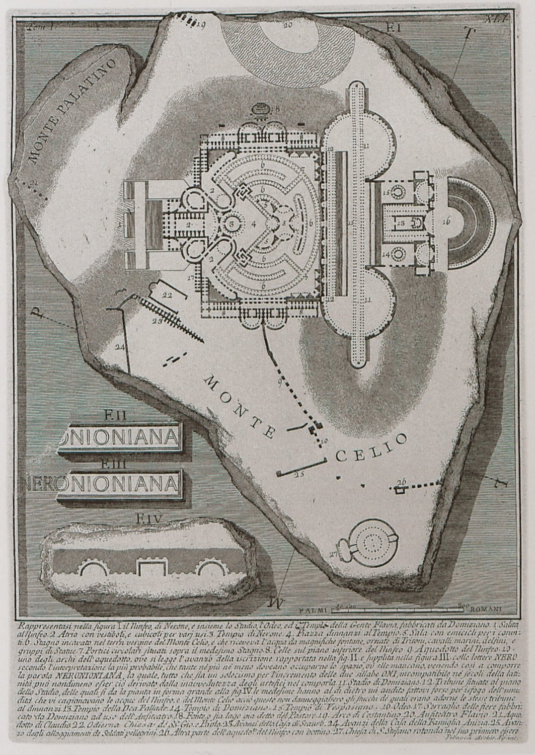
Plan of the nymphaeum of Nero at the Domus Aurea, the emperor's palace.
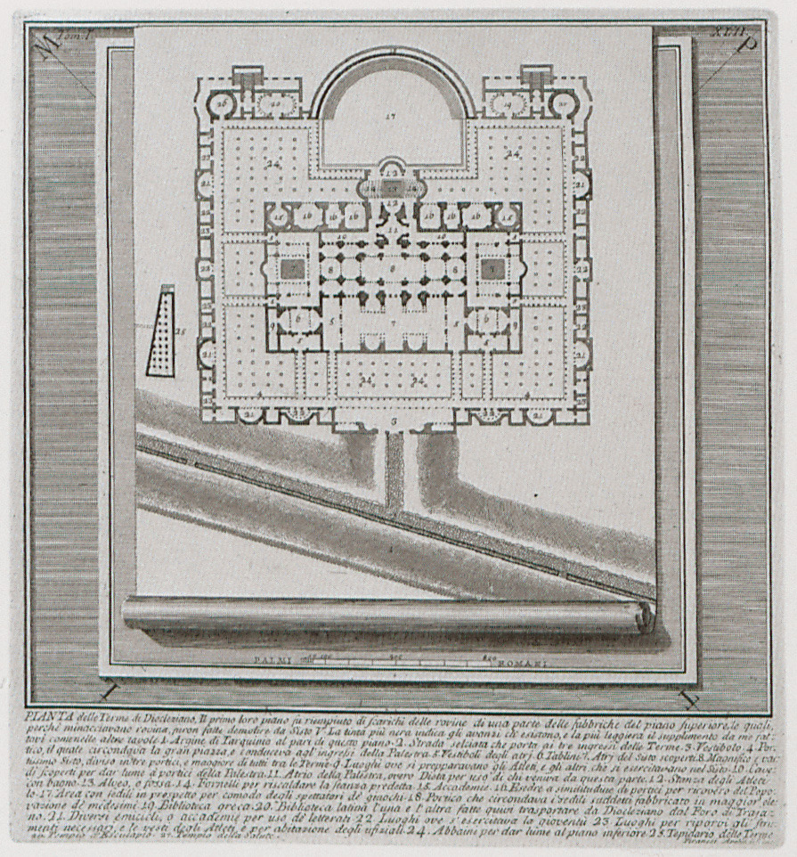
Plan of the thermae of Diocletian in Rome.
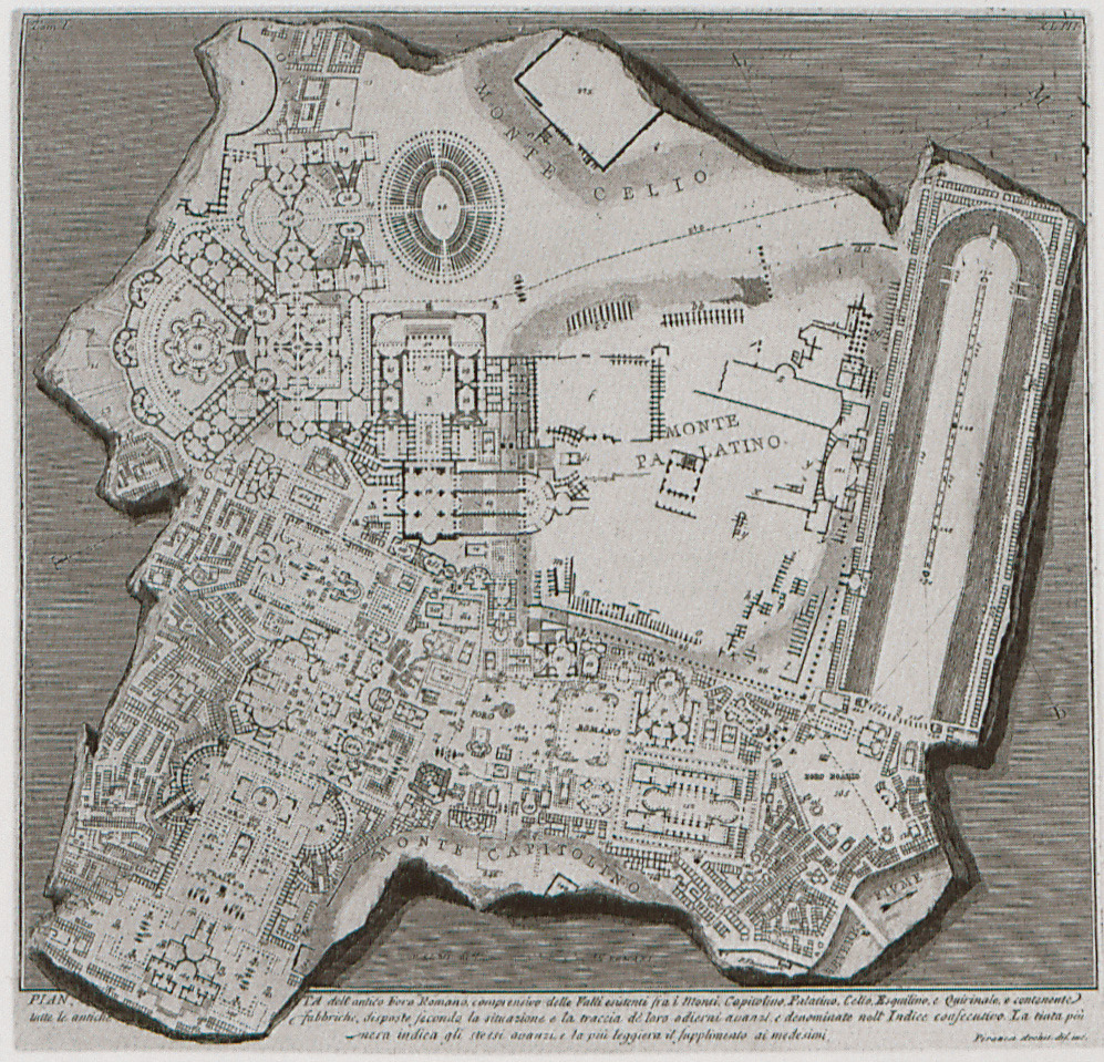
Topographic map of the Roman Forum and adjacent area, in antiquity.
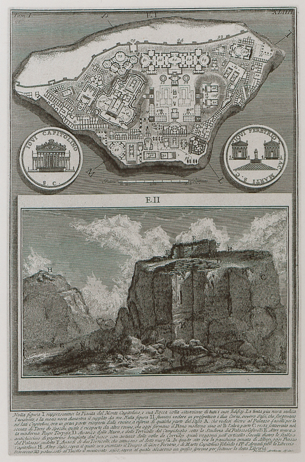
Topographic map of the Capitoline Hill.
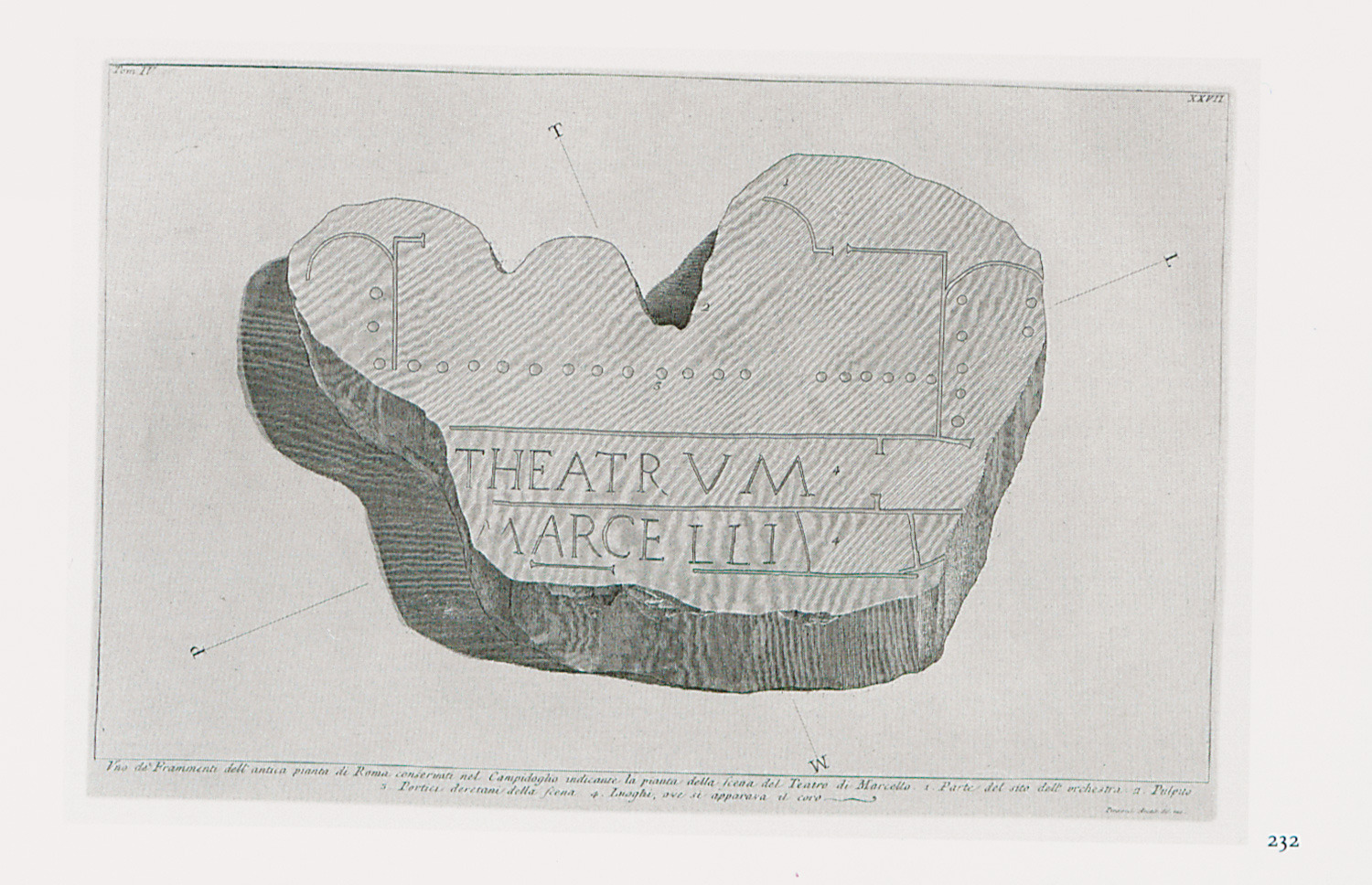
Fragments of the marble plan of ancient Rome called Forma Urbis Romae, or Severan Marle plan, created under Septimius Severus.
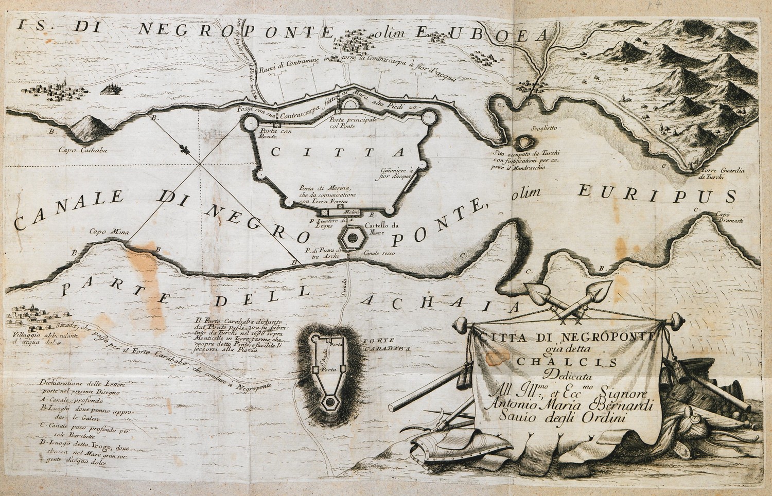
Map of Chalcis, with plans of the city walls and Karababa fortress.
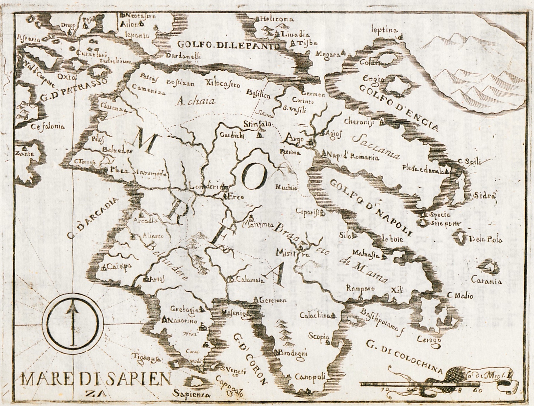
Map of the Peloponnese.
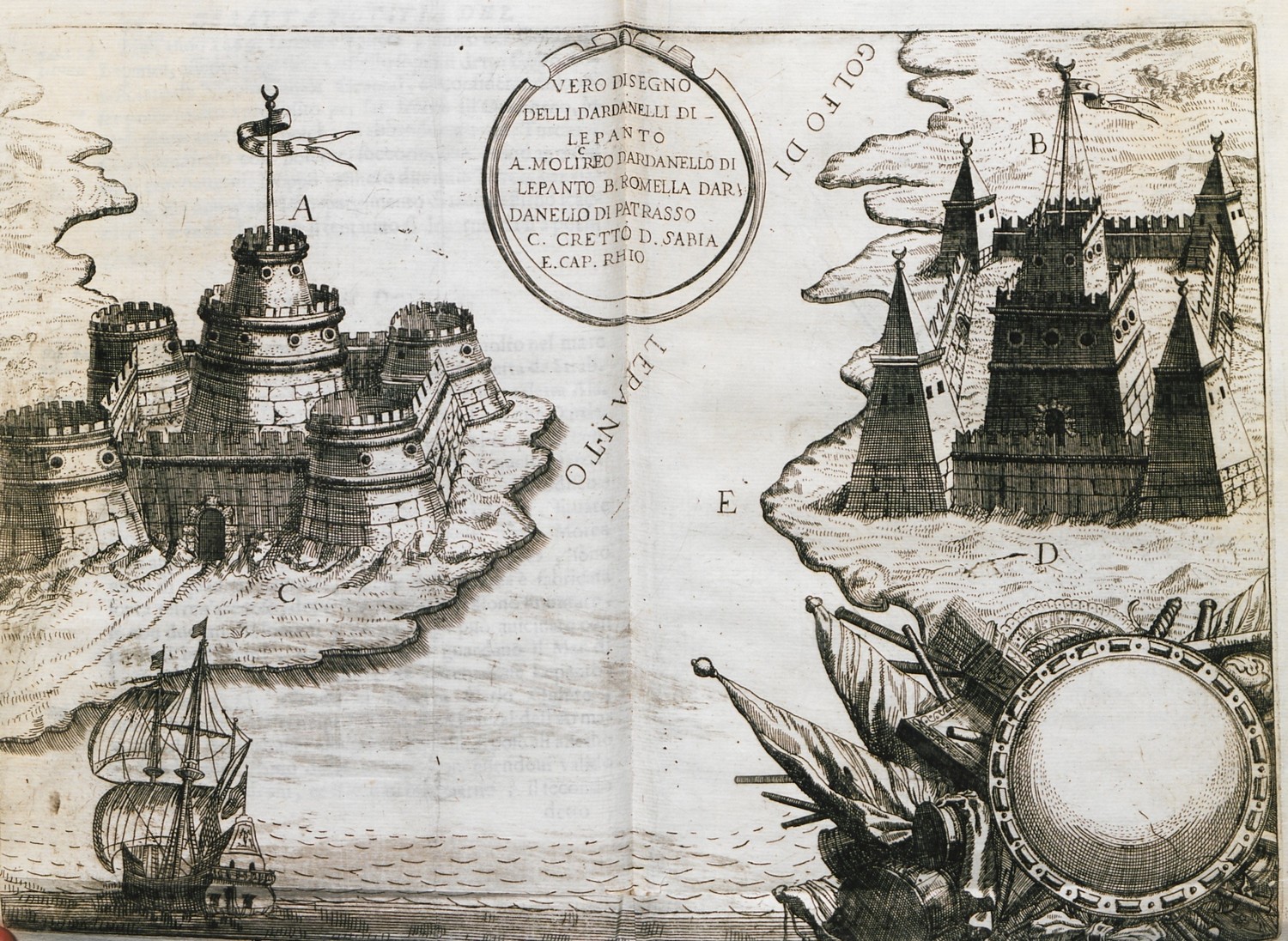
The strait of Rio with the fortresses of Rio and Antirrio.
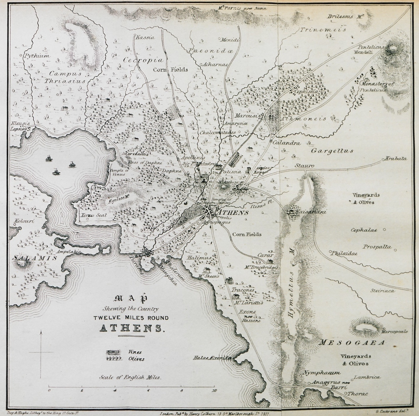
Map of part of Attica: Athens and surrounding area.
Map of Greece in the time of Otto's reign.
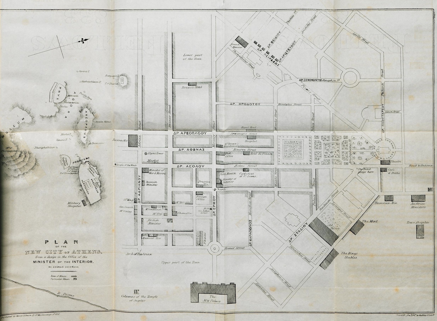
Map of the streets of Athens around the Acropolis and the Royal Palace (today Greek Parliament), according to the plan of Cleanthes and Schaubert.
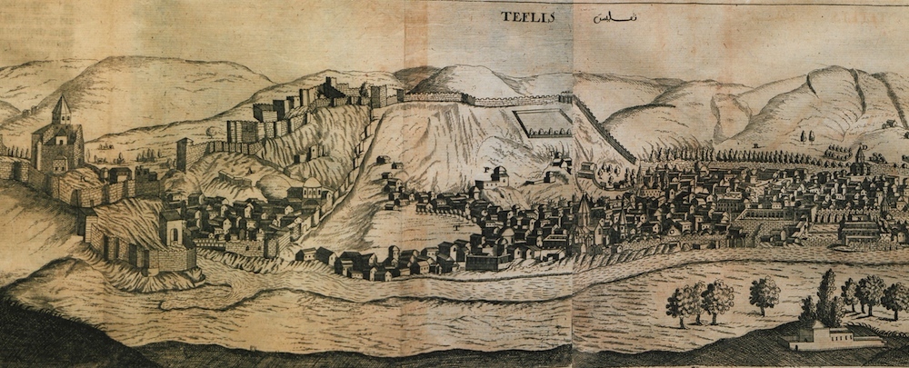
View of Tbilisi, Georgia. In the background, Narikala castle.
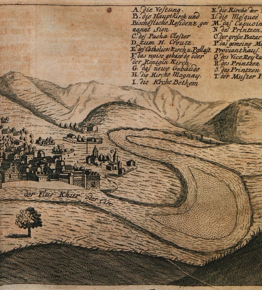
Continuation of the panoramic view of Tbilisi.