Central Greece (1691 Subjects)
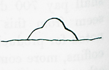
Outline of protrusion (possibly an ancient mound) near the walls of ancient Thebes.
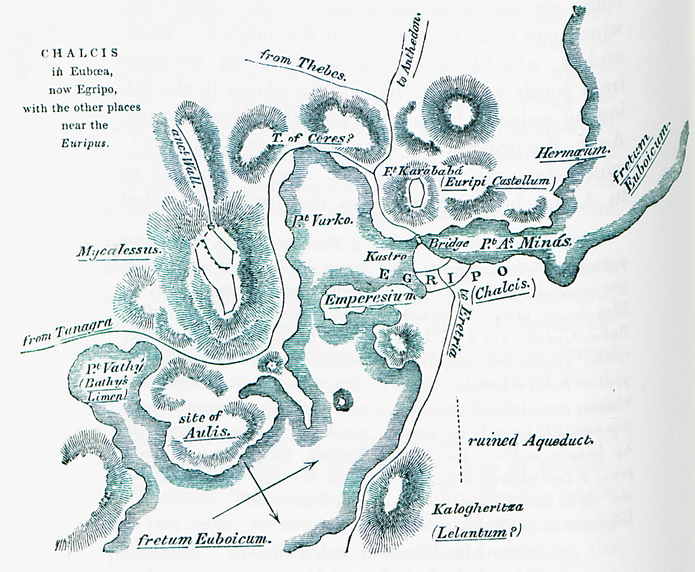
Map of Chalcis and adjacent area.
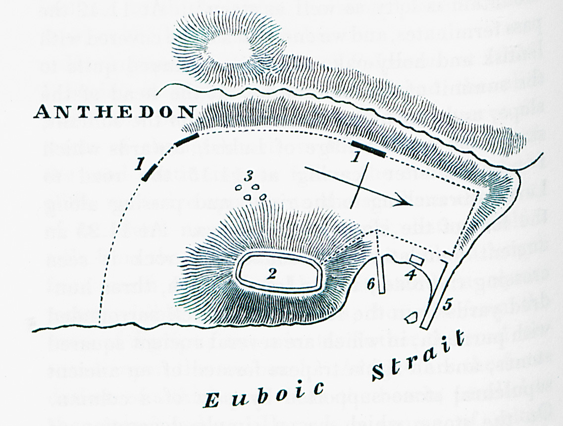
Map of the remains of ancient Anthedona at Loukisia, Boeotia.
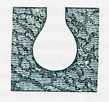
Part of spout from the acropolis of ancient Anthedona at Loukissia, Boeotia.
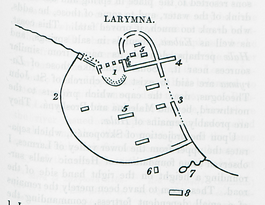
Map of ancient Larymna at Phthiotis.
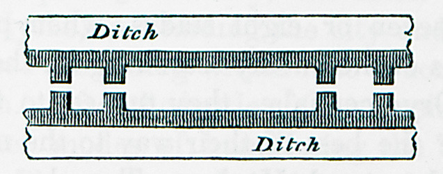
Outline of the wall erected by Lacedaemonians and Boeotians around Plataeae during the siege of the city in the Peloponnesian war. The drawing shows how hte construction of the wall permitted the allies to fight both the Athenians and the Plataeans.
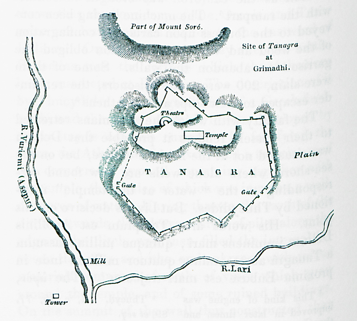
Map of the site of ancient Tanagra.
Ruins of ancient fortification wall, tower and main body, near the village of Platanakia, Boeotia.
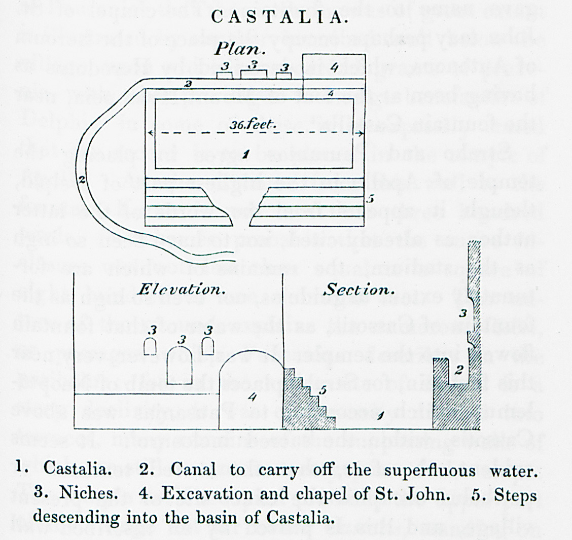
Plan, ceiling plan and transverse section of the Castalian fountain, Delphi. 1. The courtyard before the fountain. 2. The bassin at which the fountain water ended up through a covered conduit. 3. Rock-cut niches for votive offerings. 4. Church of Saint John the Forerunner. This was hte biggest niche around the fountain, and was converted into a chapel under Ottoman rule.
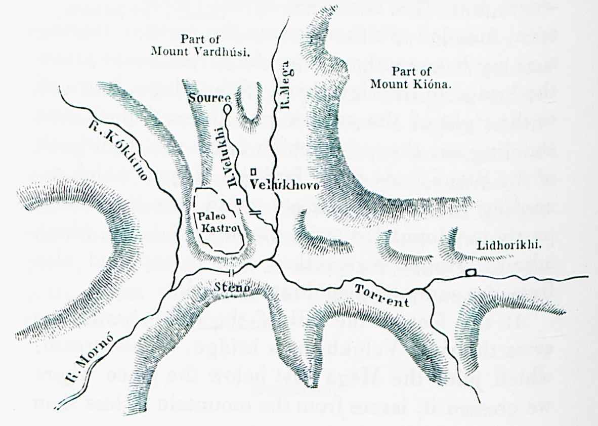
Map of Mount Vardousia, part of Pindus mountain range.
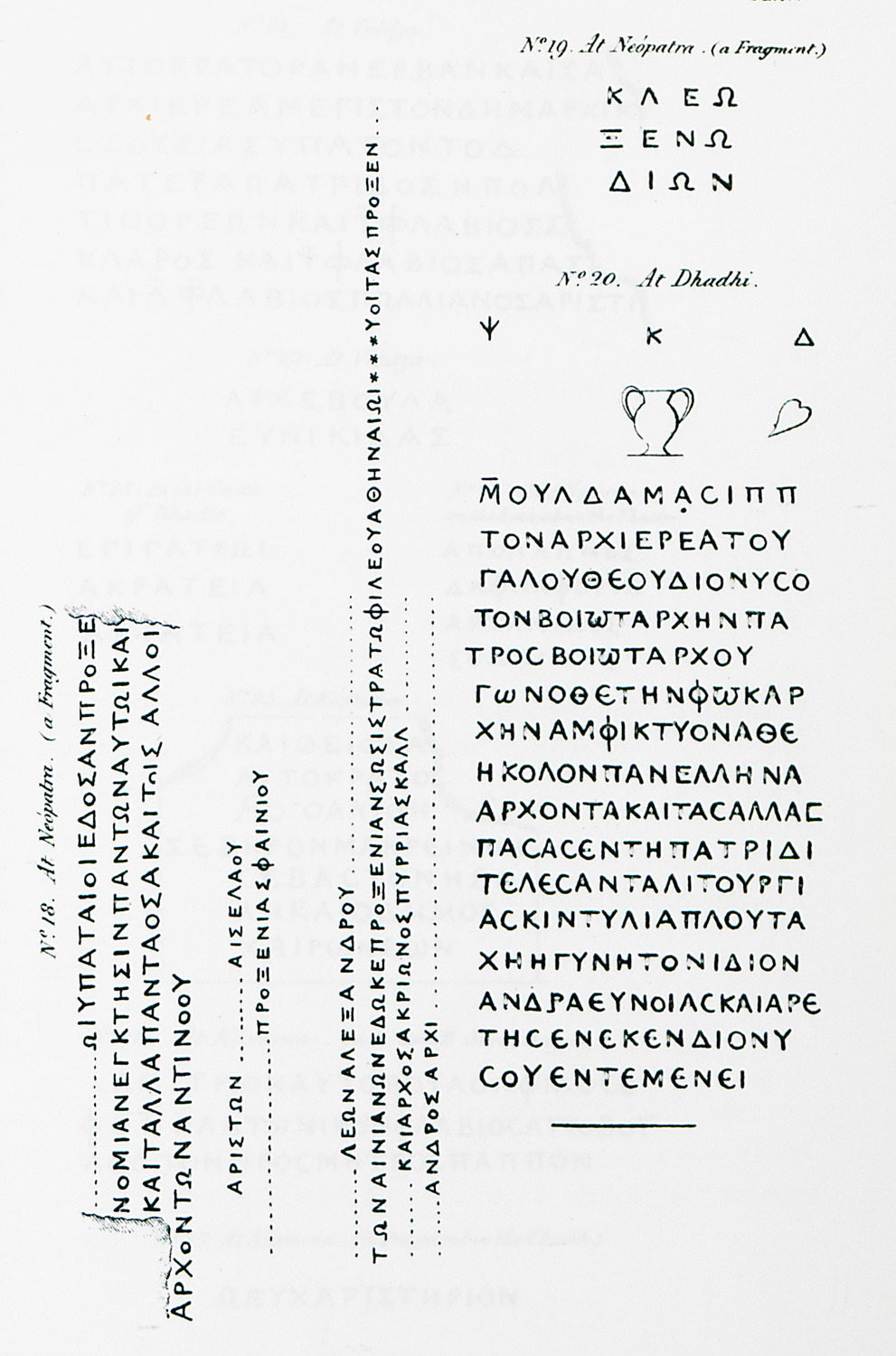
18, 19. Fragments of ancient Greek inscriptions from Hypati, Phocis. 20. Ancient Greek inscription from Amphicleia (older Dadi) in Phthiotis.
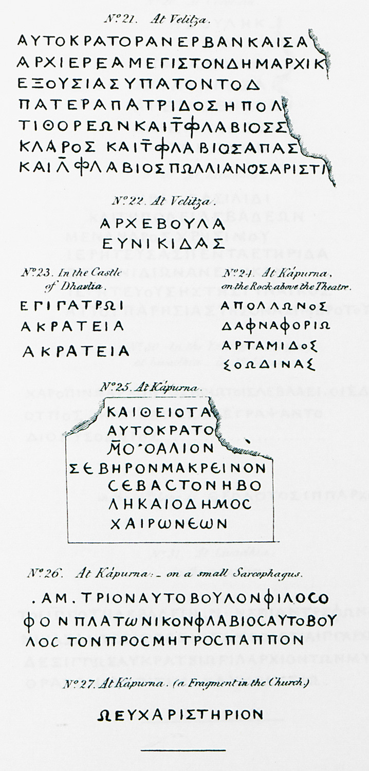
21, 22. Ancient Greek inscriptions from Tithorea (Velitsa) in Phhiotis. 23. Ancient Greek inscription from the castle of Amphicleia (Dadi). 24. Ancient Greek inscription on rock near the theatre of Glafyra (older Kapourna) near Volos. 25. Inscription from Glafyra. 26. Inscription from sarcophagus at Kapourna. 27. Inscription from church at Glafyra.
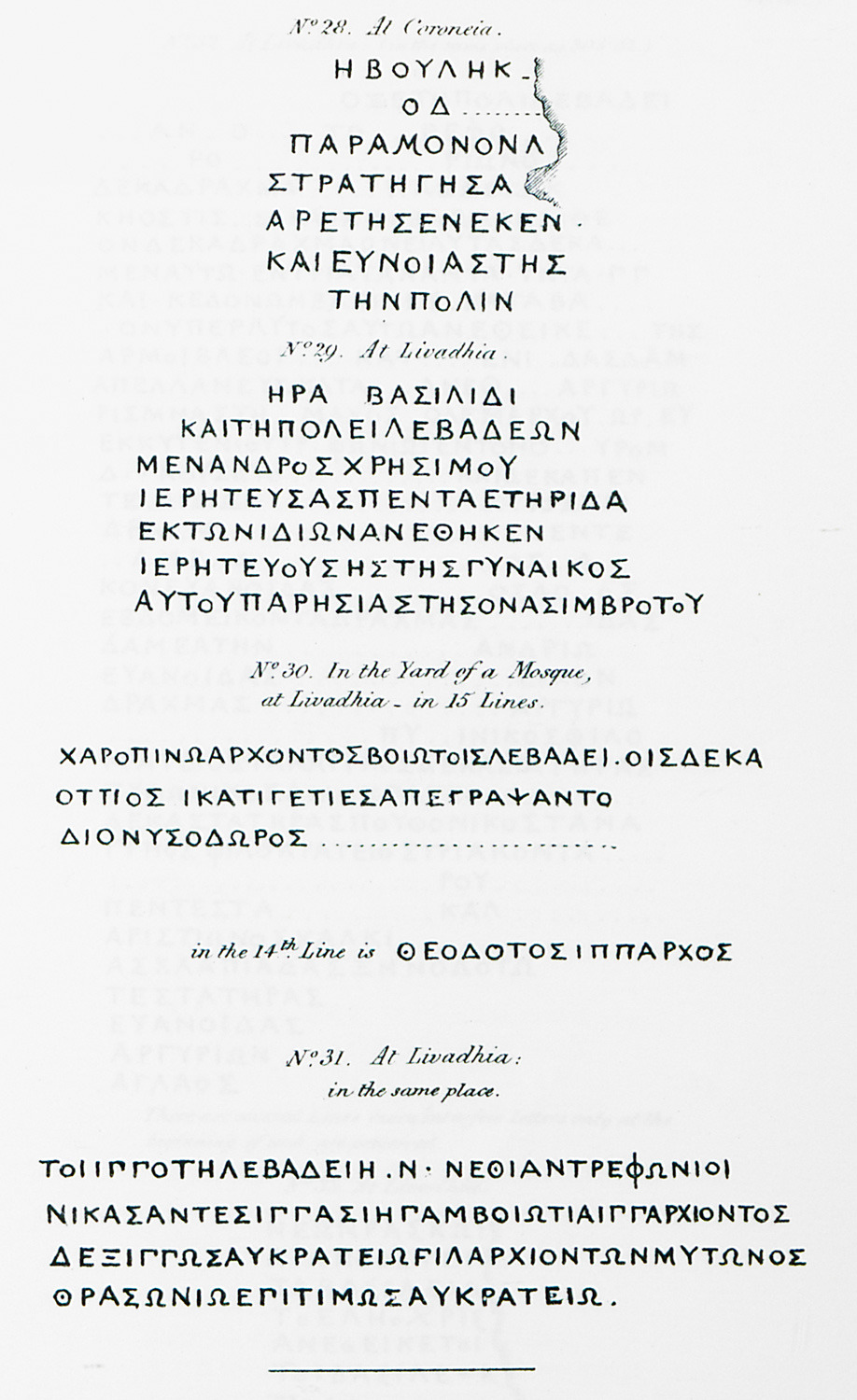
28. Ancient Greek inscription from Chaeronea in Boeotia. 29. Ancient Greek inscription from Livadeia. 30, 31. Ancient Greek inscription from the court of a mosque in Livadeia.
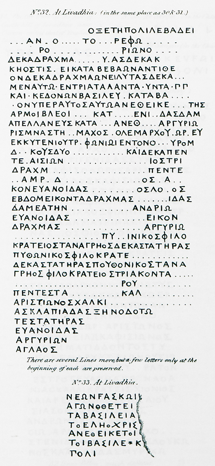
32. Ancient Greek inscriptions from the court of a mosque in Livadeia. 33. Ancient Greek inscription from Livadeia.
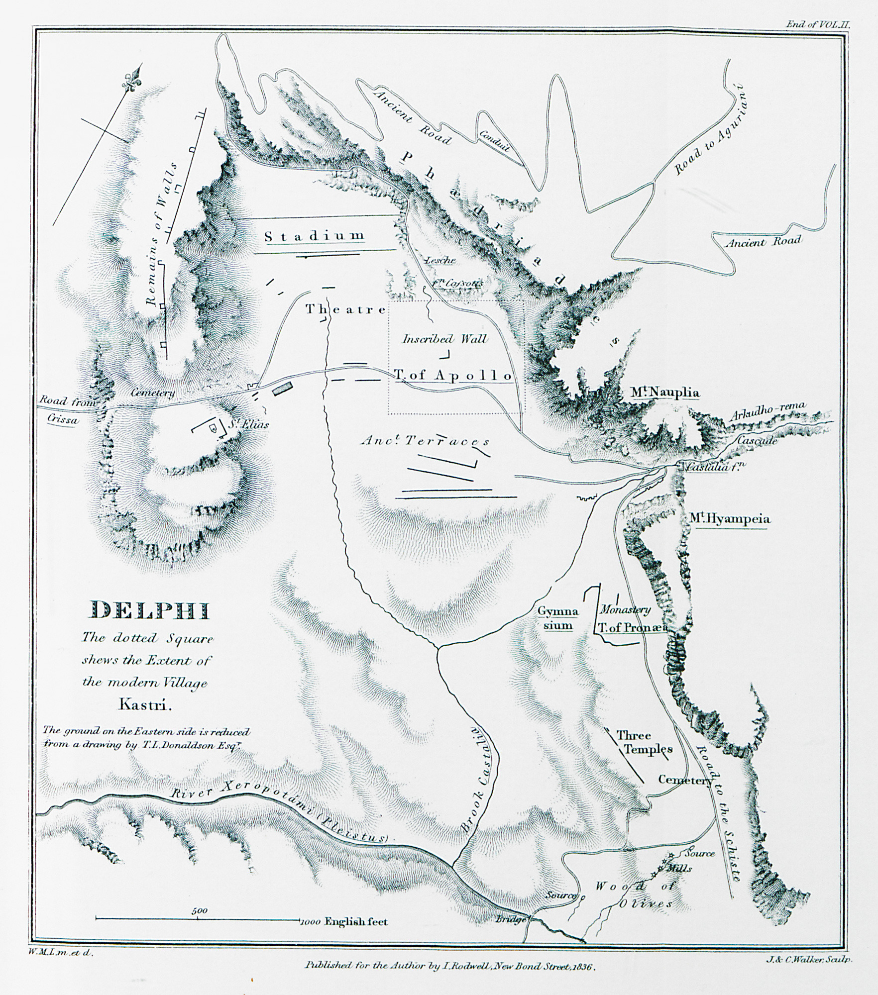
Map of the archaeological site of Delphi with the village of Kastri.
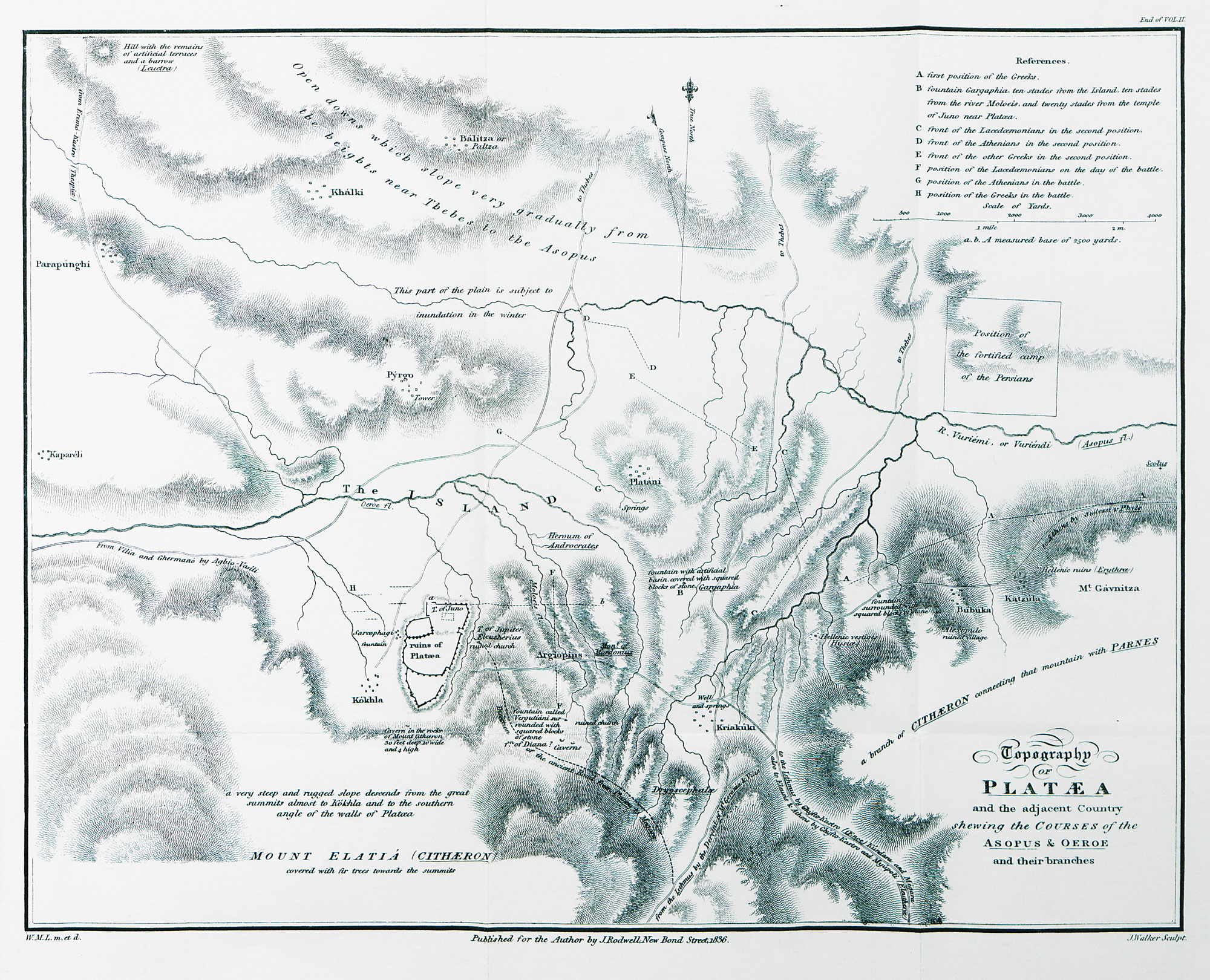
Tpographical map of Plataeae and adjacent area.
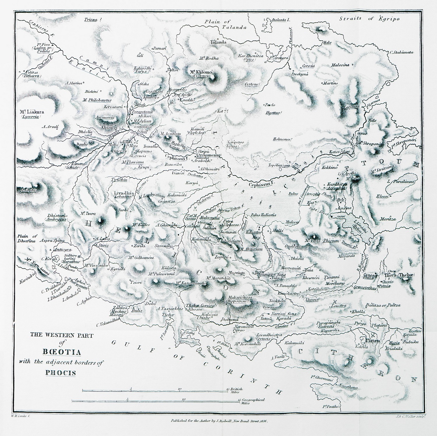
Map of the western part of Boeotia and Chalcis.
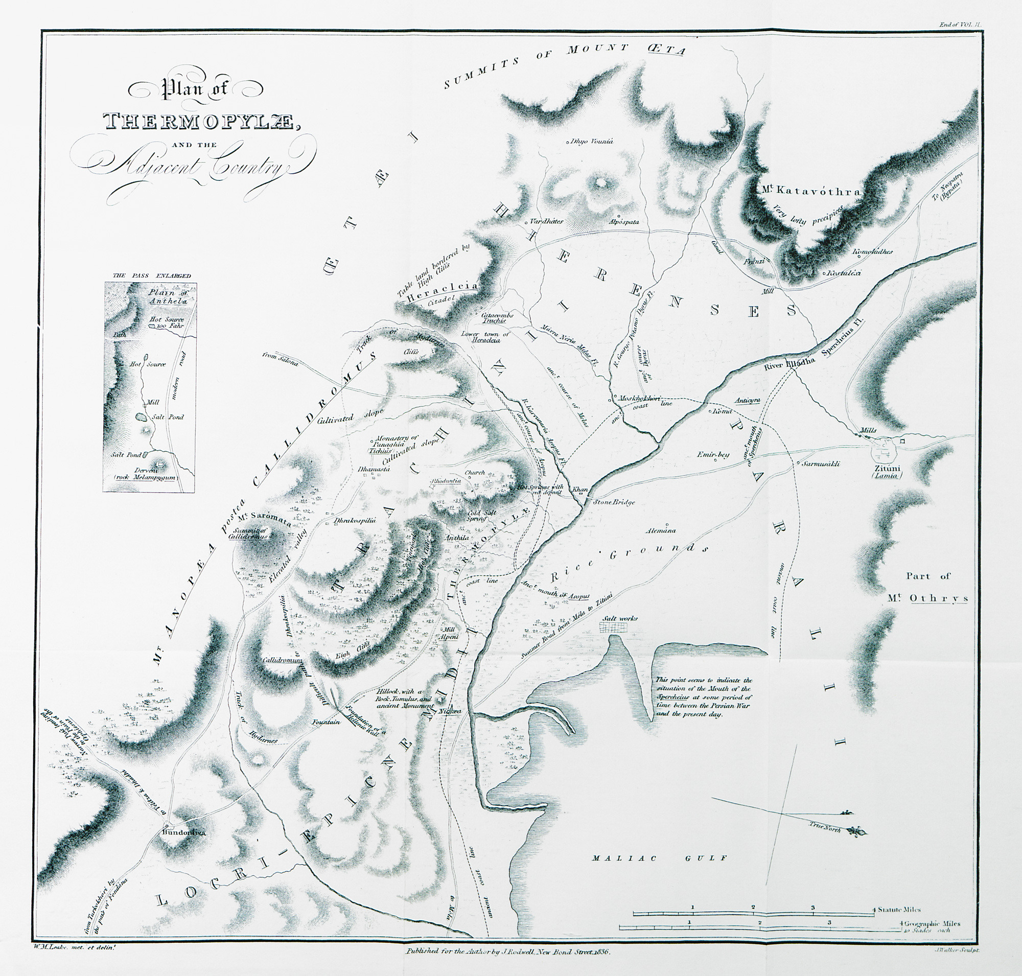
Tpographical map of Thermopylae and adjacent area.
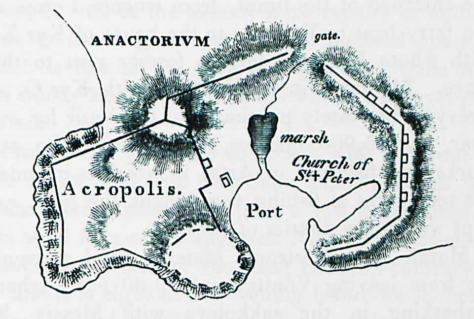
Map of ancient Anactorion, which was situated on the site of modern-day Vonitsa.
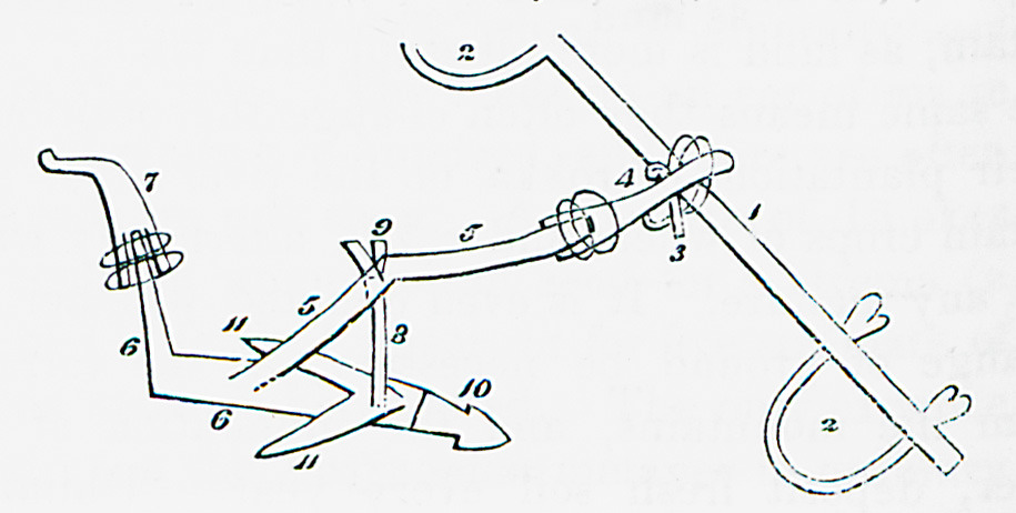
Plough.
Fountain at the southwestern slope of the acropolis of ancient Ithoria, on the hill of Profitis Ilias at Aitolikon.
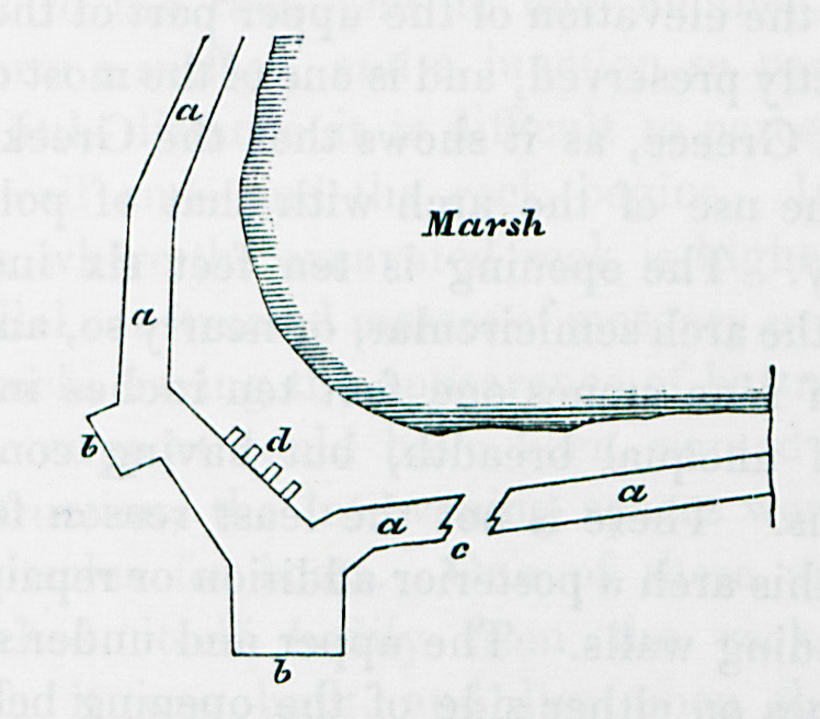
Plan of the walls of ancient Oiniadae in Acarnania. These remains are traditionally known as Trikardokastro.
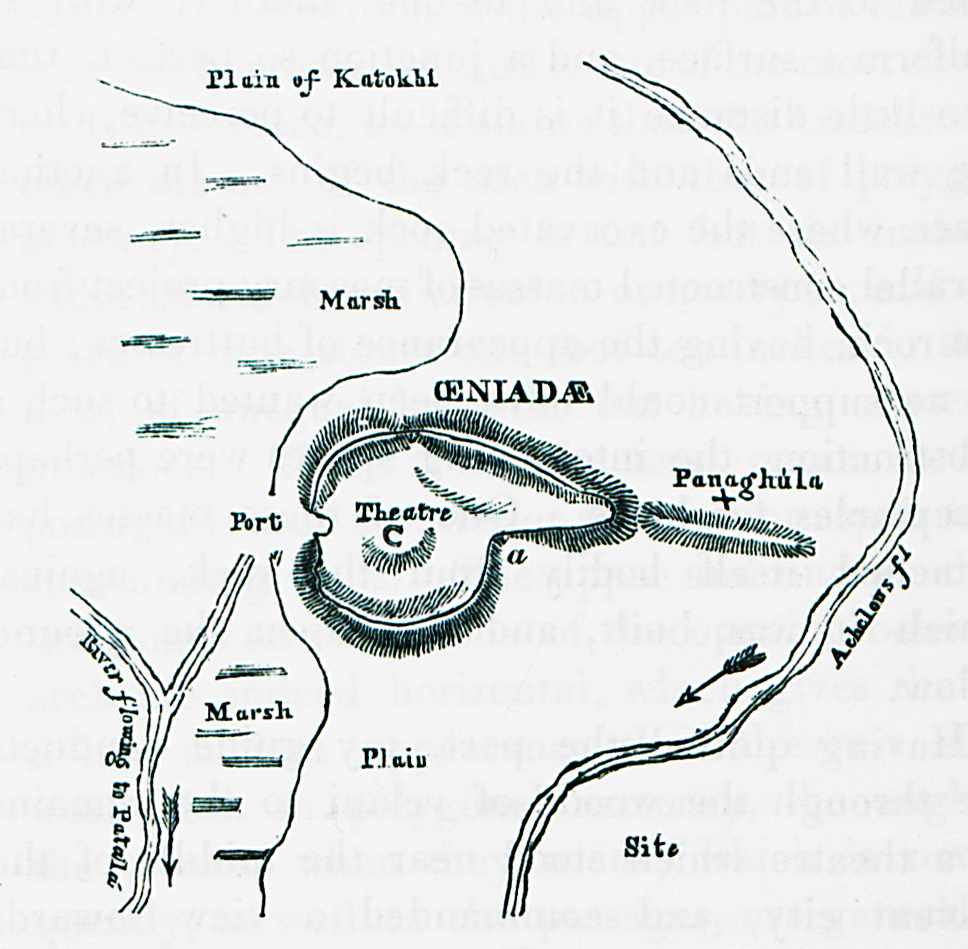
Map of ancient Oiniadae, Acarnania.
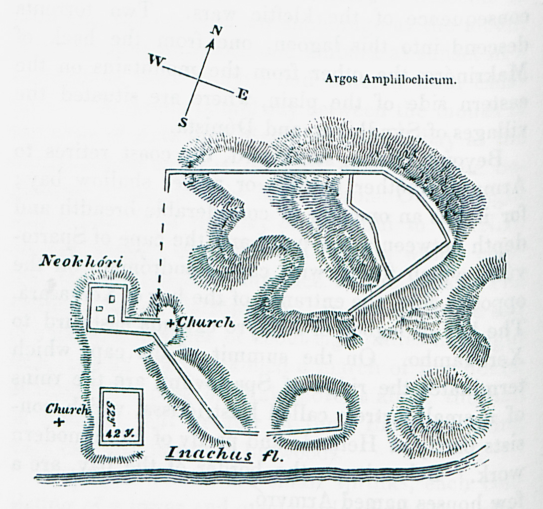
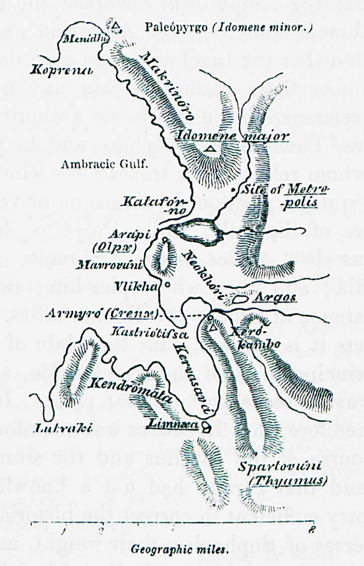
Map of Argos Ampilochium.
The bed of river Inachus at Aetolia and Acarnania.
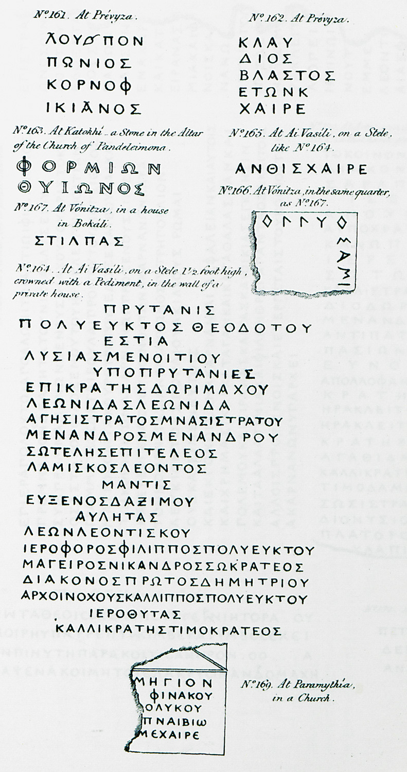
161, 162. Ancient Greek inscriptions from Preveza. 163, 165. Ancient Greek inscriptions from church altar in Katochi (ancient Oiniadae). Aetolia and Acarnania. 164. Ancient Greek inscription from Thyrreion (older Agios Vaslileios), Aetolia and Acarnania. The inscription was discovered by the author on the wall of a house. 166, 167. Ancient Greek inscriptions from Vonitsa. 169. Ancient Greek inscription from church at Paramythia.
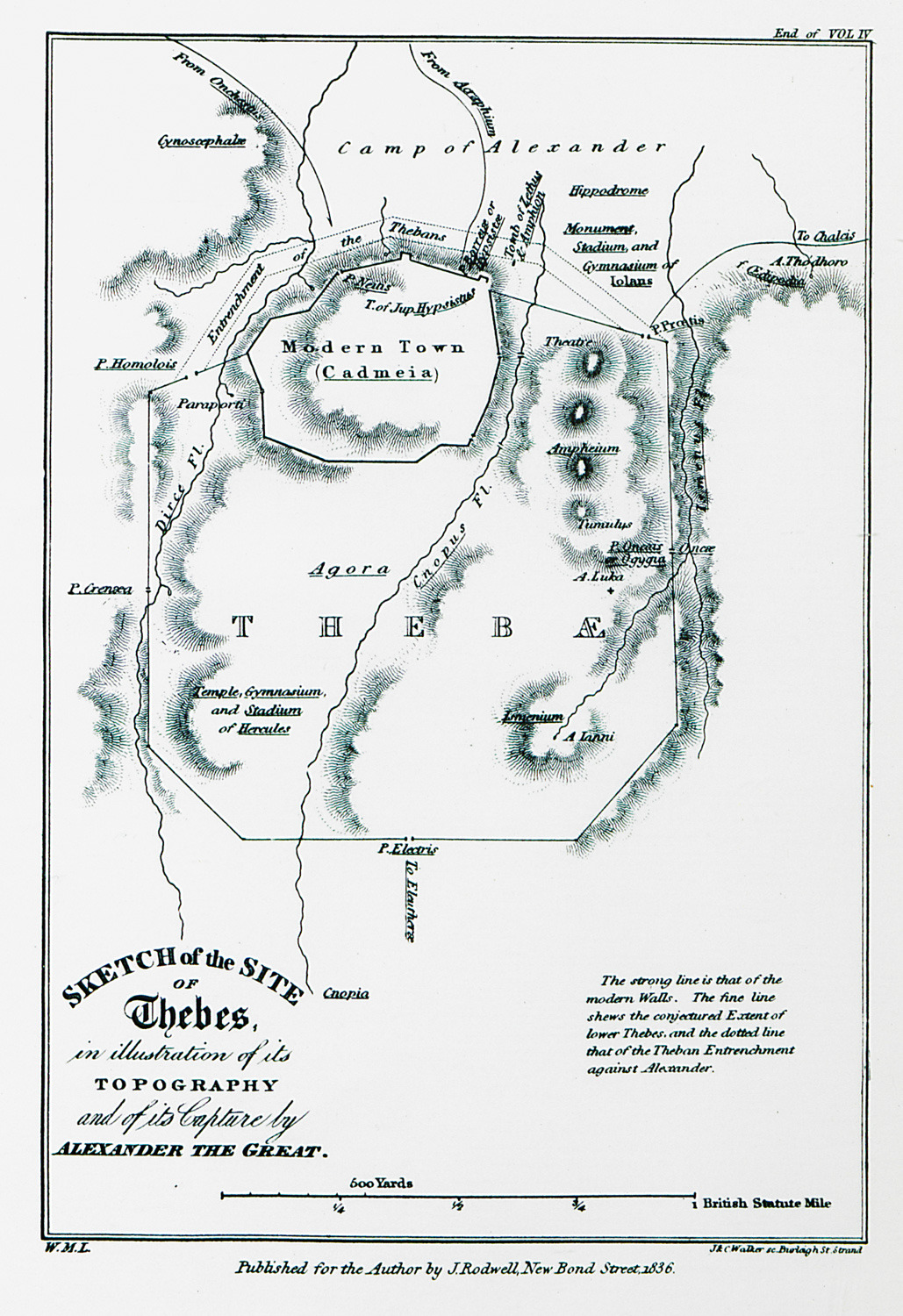
Topographical map of Thebes.
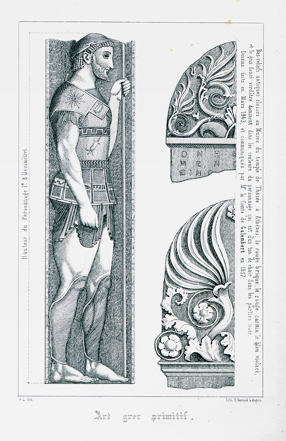
Relief from the Museum of Kerameikos, Athens.
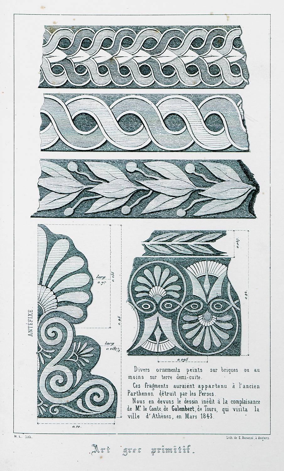
Decorative features from the Acropolis of Athens.
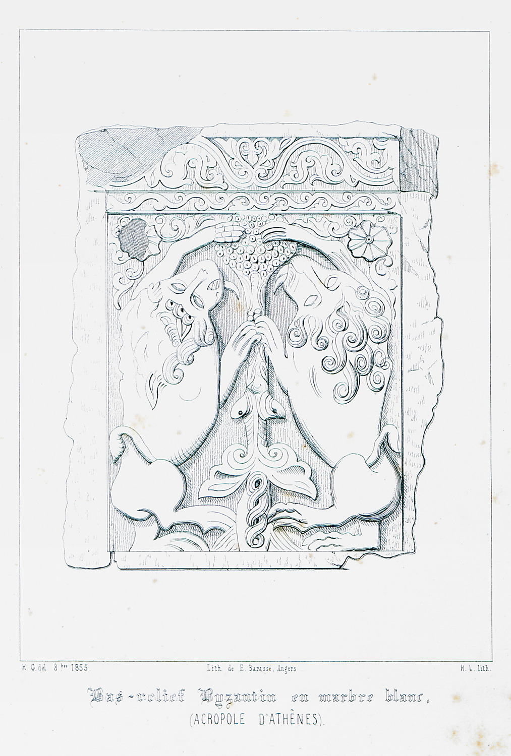
Byzantine relief discovered at the area of the Acropolis.


